Sea Level Research Group

University of Colorado

Main navigation

  • Home
  • Tide Gauge Sea Level
  • Regional Sea Level
  • Sea Level Trend Map
  • Processing
    • Processing
    • Monitoring Altimeter Drift
    • Release Notes
  • Steric Effects
  • Contact
  1. Release Notes
  2. Total Sea Level Change

Total Sea Level Change

Image
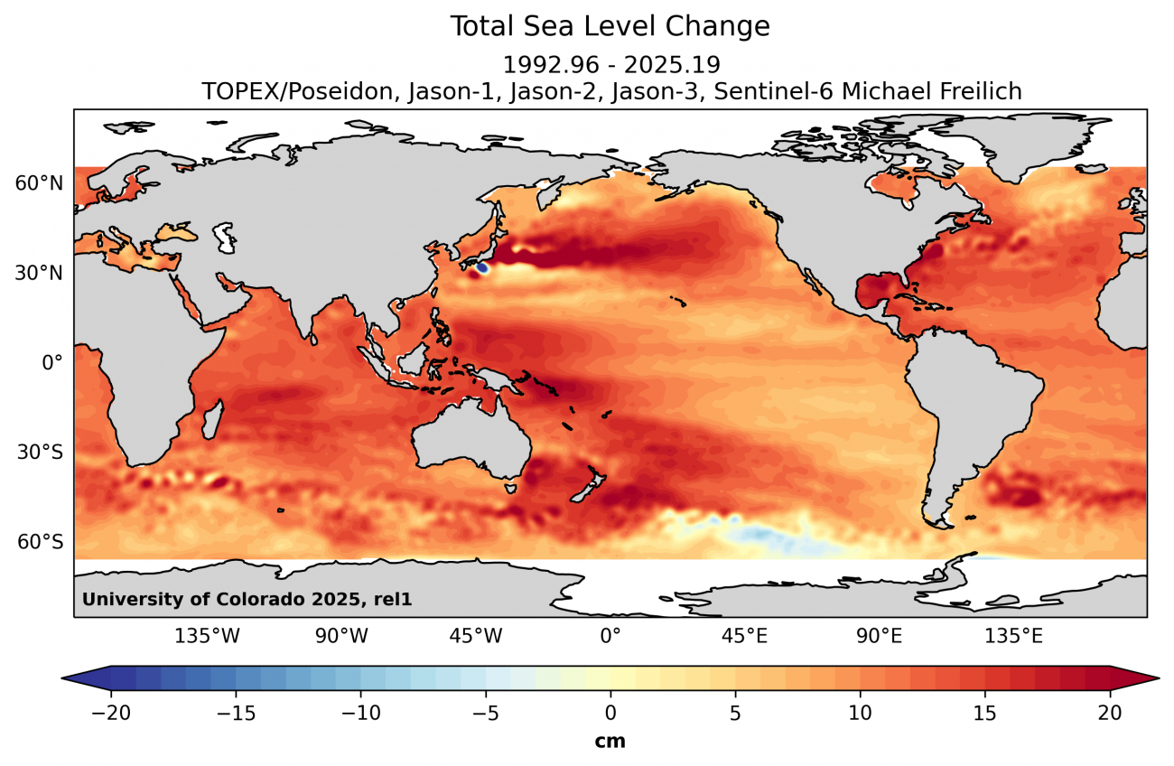
Total Sea Level Change

Download Data

Raw Data (ASCII)
cu_total_sea_level_change.nc1022.94 KB

Download Image

PDF
cu_total_sea_level_change.pdf4.75 MB
EPS
cu_total_sea_level_change.eps39.27 MB

Other GMSL Estimates

AVISO
CSIRO
NASA GSFC
NOAA

FAQs

  • What is the definition of global mean sea level (GMSL) and its rate?
  • Why is the GMSL different than local tide gauge measurements?
  • What is glacial isostatic adjustment (GIA), and why do you correct for it?
  • How often are the global mean sea level estimates updated?
  • What is the format of the dates in the GMSL time series?
  • Do you account for plate tectonics in the global mean sea level trend?
  • Is sedimentation in the oceans accounted for in the GMSL estimate?
  • What determines the x-intercept (i.e., "zero-crossing" or "base year") of the GMSL plots?
View All

Recent Publications

  • Consolidating Sea Level Acceleration Estimates from Satellite Altimetry
    T. Veng, O. Andersen
    Advances in Space Research: The Official Journal of the Committee on Space Research
  • Continuity of ice sheet mass loss in Greenland and Antarctica from the GRACE and GRACE Follow-On missions
    I. Velicogna, Y. Mohajerani, A. Geruo, F. Landerer, J. Mouginot, B. Noel, E. Rignot, T. Sutterly, M. van den Broeke
    Geophysical Research Letters
  • Are long tide gauge records in the wrong place to measure global mean sea level rise?
    P. Thompson, B. Hamlington, F. Landerer, S. Adhikari
    Geophysical Research Letters
View All

Related Links

AVISO
CLS Radar Altimetry Tutorial
CSIRO
CU Sea Level Explorer
GFZ GRACE
JPL GRACE Tellus
LEGOS-CTOH
NASA EO: World of Change
NASA Global Climate Change
NASA Sea Level Portal
NOAA Satellite Altimetry
Radar Altimeter Database (RADS)
USF Grace Ocean Mass
UT/CSR GRACE
View All

For questions or comments, please contact Professor R. Steven Nerem at nerem@colorado.edu.

We would like to thank NOAA and TU Delft for providing the Radar Altimetry Database System (RADS). For more information on RADS, visit this link.


University of Colorado • CIRES • Box 216 UCB • Boulder, CO 80309 • USA • Log In


cires logo
©CIRES 2025